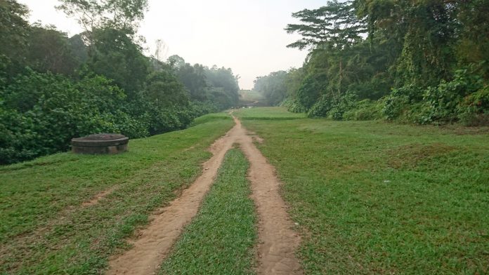
Having lived and worked mostly on the East, I am not very familiar with what’s in the West of Singapore.
When I began road cycling and running, I realised that the West is a really lumpy place, and its where most of the nice trails are. And once in a while, I’ll see some of these pipes somewhere. But I never really paid much attention to them.
Then I joined a trail run event. When I recon the route, its the first time I saw Belukar Track and the pipelines along Bukit Timah Nature Reserve. I’ve already been at MacRitchie Reservoir, but I found this sight breathtaking.
But I got more curious about the pipes. I know these are for the water that comes from Johor, so it has to lead up all the way to Woodlands.
So I Googled for articles, posts, and studied the maps. Where the pipes lay are obvious – the ground above it are clear – no structures or trees on top of it.
After planning it out, I plotted the course, and tried it.
My route goes up North:
Sixth Ave MRT station
Jalan Kampong Chantek (cross Rifle Range Rd)
Belukar Track / Bukit Timah Nature Reserve
ZhengHua Nature Park (cross Chestnut Ave)
Clearing left of BKE (until it goes under BKE)
Clearing right of BKE (cross Mandai)
Woodlands St 41 (cross Woodlands Ave)
Woodlands Centre Rd (until spiral ramp)
Pavement by housing estate until Marsiling Lane
The parts highlighted in green are on trail, or in the case of ZhengHua Nature Park (after Chestnut Ave) you can take the pavement or the open trail on the left.
Most of the articles/posts I read did mostly Rifle Range Rd <–> Woodlands St 41. The route I made start and end where the furthest I actually saw the pipes from my running and cycling around Singapore. Its a pipeline trail, right?
Looking at satellite maps, it may give you a false impression that the ground/turf over the pipes where you can run is flat like the rail corridor. Far from it. From the video, you can see the elevation profile. There’s a lot of double-digit gradients. Those who does repeats at Bukit Timah Hill (not me) would likely find this a piece of cake though. Its better to have proper trail specific shoes.
Those parts are also very open. Bring adequate protection from sun/heat, and enough water with you.
Surely, the highlight of the route is the walk over the pipeline. The pipes are just after Mandai Road. Not sure if its just me, but midway my mind started wondering “Are we there yet???” which reflected in the rise in heart rate.
For those who haven’t tried this yet, I hope you find this useful.


